Phoenix, the capital of Arizona and the fifth-largest city in the United States, sits at 331 meters above sea level in the Valley of the Sun — a broad desert basin ringed by dramatic mountain ranges. Phoenix is the hottest major city in the United States: its combination of desert latitude, low elevation relative to the surrounding mountains, and massive urban heat island effect regularly produces summer temperatures exceeding 43°C. Yet its desert setting and mountain backdrop make it one of the most visually striking urban landscapes in the American West.
Key Facts at a Glance
| Elevation above sea level | 331 m |
|---|---|
| Lowest point (city area) | 295 m |
| Highest point (city area) | 876 m |
| Coordinates | 33.4484 N, 112.0740 W |
| Country / Region | Arizona, USA |
Topography: How is the City Shaped?
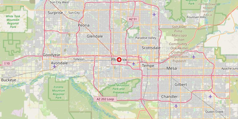
Phoenix occupies the Salt River Valley, a flat alluvial basin surrounded by mountain ranges on all sides. The Salt River (now mostly dry) flows through the basin at 295–310 m. Downtown Phoenix sits at 330–345 m. The South Mountain Park rises sharply to 742 m at the city's southern edge. Camelback Mountain (822 m), Piestewa Peak (851 m), and South Mountain (876 m) are all within the city's boundaries, creating dramatic terrain just minutes from the flat urban core.
Elevations by District
| District / Area | Elevation |
|---|---|
| Downtown Phoenix / Capitol | 330–345 m |
| Salt River bed (west) | 295–315 m |
| Scottsdale (east) | 360–450 m |
| Ahwatukee (south) | 390–500 m |
| North Phoenix / Anthem | 450–600 m |
| South Mountain (city park) | 550–876 m |
Climate and Altitude: How Elevation Shapes the City
Phoenix's desert climate is shaped by its basin position and Sonoran Desert latitude, not primarily by its 331 m elevation. Summers are extreme — Phoenix averages 110 days per year above 38°C (100°F) and has seen highs of 50°C. The "monsoon" season (July–September) brings sudden, intense thunderstorms and dust storms (haboobs). Winters are mild and sunny. The surrounding mountains intercept moisture from both the Pacific and Gulf of Mexico.
Interesting Facts About Phoenix's Elevation
- Phoenix is the hottest major city in the United States, averaging more than 110 days above 38°C (100°F) per year.
- South Mountain Park (876 m) is one of the largest municipal parks in the world — a mountain range entirely within Phoenix city limits.
- Phoenix sits in a basin that traps heat, creating a severe urban heat island effect that raises nighttime temperatures 5–10°C above surrounding desert.
- The Salt River flowing through Phoenix has been almost completely dammed upstream — the riverbed is dry much of the year, its water diverted for agriculture and urban supply.
Cities Comparison – Elevation in the Region
| City | Elevation |
|---|---|
| Tucson (AZ) | 728 m |
| Las Vegas (NV) | 610 m |
| Los Angeles (CA) | 96 m |
| Albuquerque (NM) | 1510 m |
Frequently Asked Questions About the Elevation of Phoenix
What is the elevation of Phoenix?
Phoenix sits at 331 m (1,086 ft) above sea level. Elevations range from 295 m in the Salt River basin to 876 m at the South Mountain peaks within city limits.
Why is Phoenix so hot?
Phoenix sits in a low desert basin in the Sonoran Desert at 33°N latitude. The basin traps heat, the desert air is extremely dry, and the city's massive paved surface amplifies warming — creating a severe urban heat island.
Does Phoenix have mountains?
Yes — several dramatic mountain parks are within city limits: South Mountain (876 m), Camelback Mountain (822 m), and Piestewa Peak (851 m) rise dramatically from the flat desert floor.
Does it snow in Phoenix?
Essentially never in the city proper. Snow falls on the surrounding mountains and occasionally dusts suburbs above 500 m, but the Phoenix basin almost never sees snow.
What is a haboob?
A haboob is a massive dust storm that forms when monsoon thunderstorm downdrafts pick up desert sand and roll it across the valley as a wall of dust hundreds of meters high. Phoenix experiences several per year during monsoon season.